


Oregon Fishing Reports · Eastern Region
The lower John Day runs through a desert canyon to the Columbia, a long, free-flowing river with fall steelhead.
Looking for the latest Lower John Day River report? This page is updated by the AvidMax fly shop team with live flows, current conditions, hatches and the flies working now on the Lower John Day River.
Current flows
Wind forecast
Lower John Day River fishing report
Updated November 7, 2026.
The McDonald Ferry gauge reads around 260 cfs.
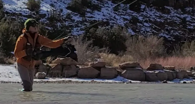
Steelhead are moving in. Swing flies through the riffles.
Load your fly box
Before you head to Lower John Day, bring: Woolly Bugger #4-6, Pat', s Rubber Legs #6-8, Egg #8-12, Zebra Midge #18-22, RS2 Emerger #18-22, JuJu Baetis #18-22, Pheasant Tail Nymph #16-20, Black Beauty #20-24, Squirmy Wormie #12-14, Scud Bomb #14-16.
Flies working right now
The flies above that we have in stock right now.
Lower John Day River details
| Access | McDonald Ferry and Cottonwood Canyon State Park. |
|---|---|
| Elevation | About 300 to 600 ft |
| Nearest town | Wasco, Oregon |
| Best season | Fall through spring |
| Fish | Steelhead and smallmouth bass |
| Regulations | Steelhead and salmon rules change often in season. Check the Oregon Department of Fish and Wildlife regulations and in-season changes before you go. An Oregon angling license is required for anglers 12 and older, plus a combined tag for steelhead and salmon. |
| Leaders and tippet | 9 ft leaders, 2X to 3X tippet |
| Camping | Cottonwood Canyon State Park |
| Kids | Partly. |
| Good to know | Remote. Few services. |
Fishing by season
Winter
Winter steelhead.
Spring
Late steelhead.
Summer
Smallmouth.
Fall
Fall steelhead.
How to get there
From Portland, take I-84 east to Biggs, then US-97 and State Highway 206 to Cottonwood Canyon State Park.